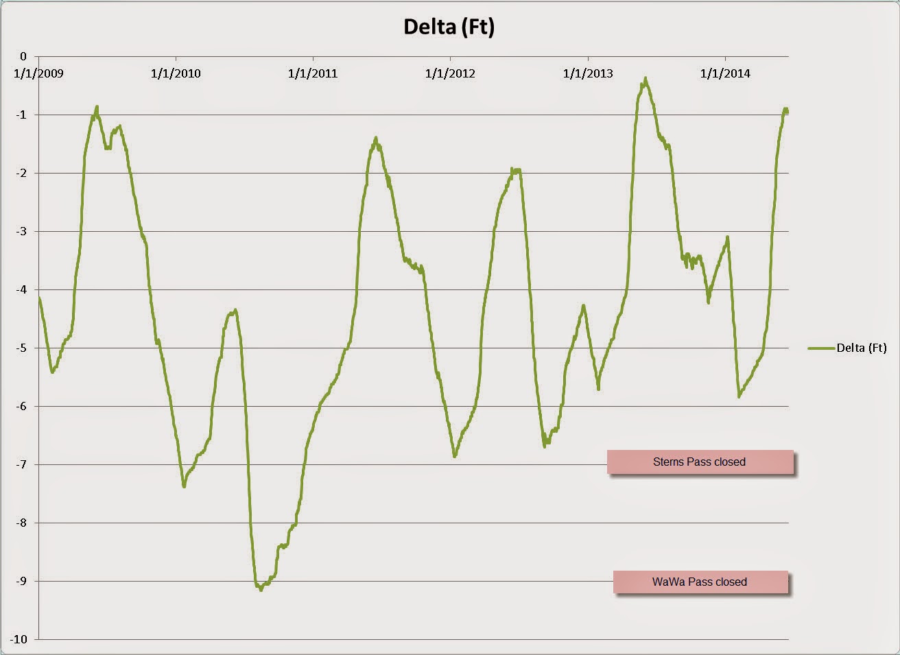
I emailed the The Ottawa River Regulation Planning Board and asked for the historical water levels of the Cabonga Reservoir and they were kind enough to send me the last five years worth of data! You can see a definite pattern here: they drop the reservoir in the fall in anticipation for a lot of run snow melt from winter and then start letting it out in late June to meet the power consumption demands of Ottawa as it gets hotter and hotter in the Summer.
.jpg)
Based on our 2010 & 2011 experiences with low water I have estimated when certain areas would be cut off from Deer Horn Lodge.
Here is a link to my spreadsheet with the data: CabongaElevation.xls. My annotations in the graph above were done with another application and will have to suffice until I can figure out how to do it on MS Excel.