.jpg)
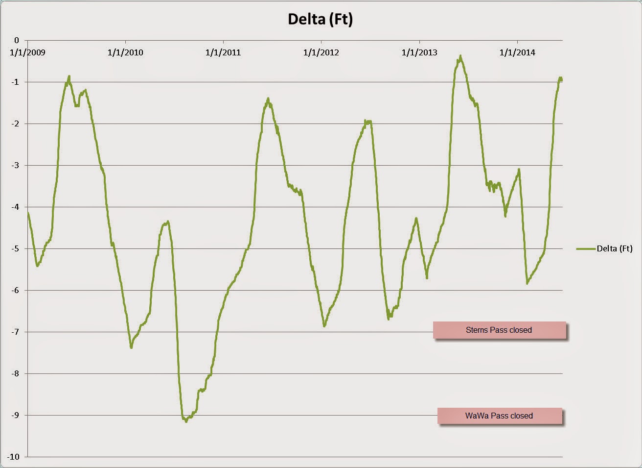
I emailed the The Ottawa River Regulation Planning Board and asked for the historical water levels of the Cabonga Reservoir and they were kind enough to send me the last five years worth of data! You can see a definite pattern here: they drop the reservoir in the fall in anticipation for a lot of run snow melt from winter and then start letting it out in late June to meet the power consumption demands of Ottawa as it gets hotter and hotter in the Summer.

I remember coming up to Deer Horn in 2010 when the water was really, really low and continually dropping throughout the week. That was the trip when we were coming into Sterns Channel when we hit a big rock with motor at 20 mph that chipped our prop and broke the skeg! That was scary!

Water was down so far that all the boats had to be tied up on the other side of the camp!

But look at how high it is on our 2014 trip!
No comments:
Post a Comment